aprs.fi and KML from Google Earth Pro
My local club will be participating in Ride the Ridges like every year and from what I was told we use a KML overlay (generated from Google Earth) on top of the aprs.fi web interface which displays all paths and icons created on the map as overlays along with all the APRS overlay information. This provides flexibility as we can track the callsigns that are relevant to this event and efficiently monitor resources out in the routes.
This is not only relevant during events like these where we have multiple moving assets in the field where we’d like to know their location at all times, but also during other events like Skywarn.
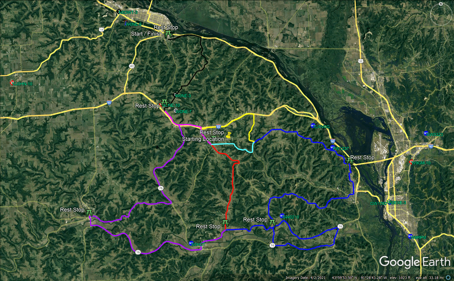
For our event, I used the web version of Google Earth and traced the paths for the routes given the requirements and then tested the KML on aprs.fi which worked, but none of the actual color data or icons I selected showed up, however the basic data for paths and the POIs I created are there.
I then downloaded and installed Google Earth Pro and loaded the KML I created previously and set to work on setting the path width (4.0) and the colors for all paths, then changed the icons for all the POIs on the course.
After all this was said and done, I uploaded the KMZ (compressed KML file) to my website and loaded the URL from aprs.fi like previous and now all the colors and icons showed up as expected.

I then chose a few callsigns on the aprs.fi interface and downloaded that XML and opened it up on Google Earth Pro and lo and behold! Live APRS tracking for desired callsigns on a 3D map with a map overlay of the course. If either of these don’t work for tracking, I don’t know what will!